mining

Aerial Survey Analysis for a Quarry

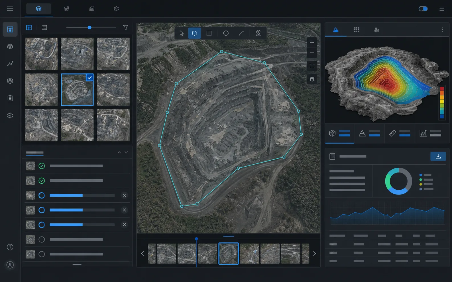
A platform for processing quarry survey imagery: material upload, reconstruction, inference, result review and client-ready reports.

data loop production-ready
01 Data
02 Processing
03 Review
04 Report
API integrations and statuses
Reports PDF, XLS, BI
AI validated on data

task

What had to be solved

Reduce manual processing of aerial survey data and produce repeatable results in a format understandable to specialists and the client.

The real project name, client, site, plate numbers, coordinates, internal URLs and identifiers are not disclosed.
Anonymized interface for quarry aerial survey analysis

constraints

What we had to account for

  • large image volumes
  • data anonymization requirements
  • operator review was required
  • PDF/XLS reports had to match the client format
Project loop
01 image processing pipeline
02 task queue
03 GPU inference
04 interactive result viewer
05 area-of-interest editor

implementation

What was built

material upload and tracking

This element is part of the full workflow: from input data to review and result.

processing statuses

This element is part of the full workflow: from input data to review and result.

review interface

This element is part of the full workflow: from input data to review and result.

report generation

This element is part of the full workflow: from input data to review and result.

error logging

This element is part of the full workflow: from input data to review and result.

result

What the business gets

  • manual work was reduced
  • results can be reviewed in the interface
  • reports are generated in an agreed format

reuse

What applies to similar tasks

  • large image processing
  • task queues
  • operator review
  • client reports

stack

Technologies and approaches

PythonFastAPIPostgreSQLGPUOpenCVPDF/XLS

next step

Need to solve a similar task?

Describe the data, current workflow, constraints and expected result. We will suggest a safe format for the first validation.